Showing posts with label New Zealand. Show all posts

Thursday, April 26, 2012

The Future or not of Christchurch Cathedral


A year ago I posted here about the earthquake in Christchurch

It is now 11 years since we visited New Zealand. You can read my account of the trip at Land of the Long White Cloud.

Seeing the damaged cathedral on the internet was especially sad.

Today I had news via Michelle's Christchurch Daily Photo that work has begun to demolish the tower. See this video.


According to the website of Anglican Taonga Bishop Victoria is pressing ahead with plans for a new cathedral in Latimer Square.

Meanwhile the Wizard of Christchurch is leading a campaign against the destruction of the old cathedral, believing that it can be rebuilt.

More information is on the Heart of Christchurch facebook page.

Wednesday, April 20, 2011

ABC Wednesday:
N is for New Zealand


It is 10 years since we visited New Zealand. You can read my account of the trip at Land of the Long White Cloud.

When the earthquake hit Christchurch we were very upset, especially as one of our neighbours had returned from a three month visit to their daughter in Christchurch only the day before. They were still getting over jetlag when the news broke.

We stayed at the Heritage Hotel in Cathedral Square. The Heritage Hotels website states
Updated 14 April 2011 - Following the February earthquake, Heritage Christchurch is not currently taking bookings and at this time a reopening date is not able to be provided. A cordon remains in place around the CBD area and as such this date is contingent on the lifting of access restrictions. Further information regarding the cordon will continue to be updated on this site as it is advised. All Heritage Christchurch staff and guests evacuated the hotel safely at the time of the earthquake.
The resiliance and spirit of people as they rebuild their city is inspiring.


Michelle's blog, Christchurch Daily Photo provides a great continuing insight to life in the city, whilst photographs of the damage to the cathedral and latest information can be found on the Christchurch Cathedral website.

For more N posts visit ABC Wednesday.

Friday, March 26, 2010

Streetview Finds (1)
Milford Highway

Googlemap's Streetview has opened up how we look at the world and I'm going to share a few of my finds from time to time.

I recently showed you my photos of the Homer Tunnel between Te Aneau and Milford Sound.

Well the googlecar didn't get that far. It went several miles up the road but eventually decided to turn round here. Perhaps the road ahead was blocked by snow?


View Larger Map

Wednesday, March 10, 2010

ABC Wednesday
H is for Homer Tunnel

This week I'm returning again to my archive of photographs from our journey to the Land of the Long White Cloud.


On Day 14 we travelled to Milford Sound with Ron Peacock a National Park Ranger. It started to rain as we left Te Aneau and steadily got worse. As we headed towards the Homer Tunnel we saw waterfalls appearing over what is normally just bare rock. Then as the rain got heavier and the surrounding rock-faces got steeper the waterfalls multiplied into an almost continuous curtain.


As Wikipedia informs us, the tunnel pierces the main divide of the Homer Saddle connecting the valley of the Eglinton and Hollyford Rivers to the east with that of the Cleddau to the west. The tunnel is straight, and was originally single-lane and gravel-surfaced. The tunnel walls remain unlined granite. The east portal end is at 945m elevation; the tunnel runs 1270m at approximately a 1:10 gradient down to the western portal. Construction of the tunnel began in 1935 but it wasn't completed and opened until 1954.


Here is the Eastern portal after we had passed through it on our return journey. Yes there it is down in the bottom right of the photograph. At the bottom of the mountainside are piles of dirty snow.


For more H posts visit ABC Wednesday.

Wednesday, February 10, 2010

ABC Wednesday:
D is for Doubtful Sound


Doubtful Sound is in a remote corner of New Zealand. It is reached by taking first a ferry across Lake Manapouri to West Arm. There you transfer to a coach for the drive over the Wilmot Pass to Deep Cove.


At Deep Cove you leave the coach and board a catamaran for a cruise on Doubtful Sound. Although given its name in 1773 by James Cook, the fjord was unexplored until the Italian navigator Malaspina commanded a Spanish scientific expedition in 1793. His name is remembered in Malaspina Reach, the area between Hall Arm and Crooked Arm. It was here that we were joined by some bottlenosed dolphins who sailed with us and provided a spectacular show jumping out of the water and somersaulting back.


As you approach the Tasman Sea, there are clear views of the Nee islets, named after a Spanish botanist. On the southern entrance, beyond Febrero Point are two rocks known as the Hare's Ears.

You can read more of our 2001 journey to New Zealand on The Land of the Long White Cloud.

For more D posts visit ABC Wednesday.

Wednesday, December 02, 2009

ABC Wednesday - T is for Tasman Glacier


This week I thought I'd post some more photographs from our 2001 tour of the The Land of the Long White Cloud.

Here we are flying over the Tasman Glacier with Mounts Cook and Tasman skylined.


This second photograph sees us looking South from Mount Cook over Tasman Glacier Terminal and Lake Pukaki.

For more T posts visit ABC Wednesday.

Wednesday, November 18, 2009

ABC Wednesday - R is for Rotorua


This week I've been looking through my archives and decided to post eight images from Rotorua 2001. They were taken with an early Olympus digital camera and are only 640 x 480 pixels but with the modern photo-software I now use I've been able to reveal more details than were evident when I originally downloaded them.


Rotorua was one of the stops on our tour of New Zealand which I describe in my journal THE LAND OF THE LONG WHITE CLOUD.


We reached Rotorua on Day 22


In the early evening we were just driving around and found ourselves at Kuirau Park. On the 26th January 2001, less than two months before our visit, an eruption occurred. Mud, steam and debris were thrown into the air. Notices warn visitors to enter at their own risk and not to cross the makeshift fences.


I went walkabout discovering ash-covered trees, small lakes of boiling mud, and large swamp lakes over which hot sulphurous clouds blew. It was the weirdest scene I had ever encountered. Beyond the park were modern buildings.


Much of the grass was green, but it was not a place for picnics nor football. The fumes, as long as one stayed away from the thickest clouds were not overpowering.


For more "R" posts visit ABC Wednesday.

Sunday, October 11, 2009

Shadow Sunday: The Wizard of Christchurch


This week my contribution to Shadow Shot Sunday dates back to 2001 when we joined the crowds in Cathedral Square, Christchurch, New Zealand to listen to the Wizard.

In my Journal The Land of the Long White Cloud I wrote
I wander off down to Cathedral Square to listen to The Wizard. Since 1974 he has been speaking in the Square and can be heard most weekdays from 1 to 2 p.m., November to March. Although the City Council were first opposed to him, he is now regarded almost as an institution. Described by some as a misogynist, today he expounds his theory that the cause of all the wars of this world is "women's need to go shopping!" He is in fact a congenial, accessible gentleman and not a woman-hater at all. After his oration, several of the crowd of three-dozen or so listeners, talk to him. He was born in the UK and I told him I was from Manchester. A young mother who'd been talking to him about the New Zealand education system, asks me where in Manchester I'm from. When I tell her I'm from Hyde, she reveals that she's originally from Dukinfield [the next town] — o what a small world this is! The Wizard tells us that he's heading off to Australia in the afternoon to avoid the New Zealand Census.
I heard later that the Wizard had retired but the Wikipedia entry for him indicates that he still active.

For more shadow shots visit Hey Harriet.

Wednesday, December 31, 2008

ABC Wednesday - X is for Xylogenous Fungi


Xylogenous fungi are ones that live on wood. Those above were found in New Zealand close to Tane Mahuta, the biggest and oldest living Kauri tree.

These below were growing on a tree at Nacton churchyard in Suffolk, UK.


More X posts can be seen on the ABC Wednesday Anthology blog.

Others can be found via the ABC Wednesday with Mister Linky which carries a registry of participants.

Thursday, November 20, 2008

Shearsman ##77 & 78

The latest double issue of Shearsman is ##77-78.

Christopher Middleton provides a string of poems about birds
the barn owl on his beam,
kestrel swivelling on a shaft of air
...
the ways their plummage
fits the planes
or tunnels in the air,
...
lonesome the loon calls back birds of Ur,
birds of Babylon,
for brilliant breeds have perished probably.
Gregory O'Brien gives us a set of poems based on the Spanish exploration of Doubtful Sound, New Zealand in 1793.
Punta de Espinosa

Together we played the wind-tossed
waters of Wet Jacket Arm.
Carrie Etter takes us along McLean County Highway 39
tar shrugs goes to dirt
gravel's slow crunch over
winter with no hill for
frost to the horizon
Astrid van Baalen writes of The saddest tree at Kew
There are words that twist the finger raw
like only once, and yet again once more.
Janice Fixter has been to Staffa
There's a wooden boat lurching against the storm tide
and for the first time violins are stringing out Hebridean notes

inside a stranger's head.
I know the feeling, ever since August 1984, just the name brings the music into my head and the cry of "green tarpaulins" but that's another story.

Also impressive in this issue, of which I've mentioned but a fraction, are George Messo's translations of Birhan Keskin.
Shearsman
58 Velwell Road
Exeter
EX4 4LD
UK
ISSN 0260-8049
£8.50 [$13.50]
Subscriptions: 2 dble-issues £12 [Europe £14; RoW £15]
cheques [sterling only] payable to "Shearsman Books"

visit the website of Shearsman Books
Read an account of Issue ##75-76.

Read reviews of earlier issues on NHI Review.

Wednesday, November 05, 2008

ABC Wednesday - P is for Paradise


Two weeks ago I posted N is for Ninety Mile Beach. Today we are returning to New Zealand but moving from the far North to the far South and visiting Paradise.

The road starts from Queenstown and heads along the the shores of Lake Wakatipu towards Glenorchy.


The road traverses sheep pasture.


In the distance are the snow-capped peaks of the Forbes Mountains.


At Diamond Lake there is a short section of forestry. Black swans and their cygnets are swimming in the lake.


Eventually the road comes to an almost dry river crossing.


I decide that this is really suitable only for 4WD and not for a hire-car. We turn our backs on the Forbes Mountains and head back, stopping to look at the For Sale signs.


In the UK one usually buys a house and the land comes with it. New Zealand practice seems to be to sell off sections of land and then build a house on the land. If you buy another piece of land you move the house, lock stock and barrel to the new location. That day in 2001 we could have bought our own little piece of Paradise.

You can read more about our visit to Paradise on Land of the Long White Cloud.

More P posts can be seen on the ABC Wednesday Anthology blog.

Others can be found via the ABC Wednesday with Mister Linky which carries a registry of participants.

Wednesday, October 22, 2008

ABC Wednesday - N is for the Ninety-Mile Beach on New Zealand's North Island


The route on to the Ninety-Mile beach is a drive along the Te Paki stream which is actually quicksand! It leads past huge sand-dunes that tower above.


Once beyond the quicksand, the driver stops by the side of a dune. Now the fun begins. He gets out boards from the coach's luggage compartment and hands them out. The idea is for everyone to indulge in the unique sport of dunebogganing. It is similar to tobogganing, but played on sand instead of snow.


All those who have the energy climb to the top of the dunes, a rather painstaking slog in itself.


They then lie on the boards and slide all the way back down to the bottom. After about half an hour of this, most people are quite exhausted.


At the end of the dunes, the driver does a 360 degree turn to enable us to get an idea of the expanse of the Ninety-Mile Beach.


The name is a misnomer as it is only about sixty miles or ninety kilometres, but that is still a long way. Accessible for about two hours either side of low-tide, the beach is actually designated State Highway 1. As we thunder down it, the wealth of seabirds just ignore the traffic.


The parallel road we had earlier used to reach Cape Reinga is designated 1a.


Shell-fish known as abalones are found here. The seabirds pick them out of the sand, fly into the air and drop the shells in order to crack them open.

A fuller account of our trip to the Northernmost tip of New Zealand can be found on our cruise journal.

A bonus photograph can be found at my N entry on ABC Wednesday.

More N posts can be seen on the ABC Wednesday Anthology blog.

Others can be found via the ABC Wednesday with Mister Linky which carries a registry of participants.

Wednesday, April 02, 2008

ABC Wednesday - K is for Katikati Haiku Pathway

ABC Wednesday: K is for Katikati Haiku Pathway

beneath the moon
the heron's slow step
towards frog sound

Michael Dylan Welch
photograph © 2001, 2008 gerald england

The Katikati Haiku Pathway was the brainchild of Catherine Mair. It was created as part of a millennium project that sought to reclaim wasteland around the Uretara Stream which seperated the centre of this Western Bay of Plenty District town in New Zealand from the Highfields area.


watchful the night heron lowers his neck into shadow

Janice Bostok
(photograph © 2001, 2008 gerald england).

I visited Catherine in 2001 and she took me on guided tour. She told me about how she came to choose the haiku used, and about the way the town co-operated, despite certain opposition, with its creation. The boulders had weathered well. After rain, water gathers in small pools on some of the lettering. We poked our fingers into one such pool. I wrote
splash of water
trickles down the stone
finds its own pathway
after visiting the above boulder.


on the farmland
new houses
slowly rising

Patricia Prime
photograph © 2001, 2008 gerald england


shadows
on the river
darker than the birds

Catherine Mair
photograph © 2001, 2008 gerald england


Holding the water,
held by it -
the dark mud.

William J Higginson
(photograph © 2001, 2008 gerald england)

Catherine tells me in a recent email that since my visit there has been massive development.
  1. The 'river flats' are now a jig-saw of roofs and burgeoning gardens.
  2. Haiku on 24 boulders has been repainted.
  3. Two damaged author nameplates have been replaced.
  4. A much more visible sign has been designed
  5. Information boards are being designed and will be in place soon at the main car park.
  6. Three new boulders have been engraved adjacent to the original landing.
  7. Stepping stones have been installed to one boulder.
  8. A viewing area has been cleared to another boulder situated in the river bed.
  9. The Haiku Pathway booklet has been updated and reprinted.


Catherine Mair standing by the exit from the Haiku Path near two carved pieces created by a Maori carver representing one of the three marae in the district. They have since been removed for restoration.


in the evening
the bridge becomes dangerous
tonight's moon

Takebe Ayatari
(photograph © 2008 Sandra Simpson)

Secretary of the Pathway Focus Committee, Sandra Simpson tells me
We now have 30 engraved haiku boulders, which we believe to be the largest such grouping in English anywhere and the largest outside Japan. The poems are by 26 poets from New Zealand, Australia, Canada, the US, Japan, Poland and England (Alan Summers).

The Haiku Pathway guidebook was updated and reprinted to coincide with the dedication of the 3 new boulders last winter (our winter May/June).

The next 2 big projects to bring to fruition are a major new entry sign, the design of which is in keeping with the pathway, and information boards for visitors, including items such as a map of all the boulders and some background to haiku.
One of the new boulders is


summer clouds
the river and I
inclined to the sea

Peter Yovu
(photograph © 2008 Sandra Simpson)

Further information is available at Katikati Mural Town.

Discover other ABC Wednesday posts by visiting Mrs. Nesbitt's Place.

Wednesday, December 05, 2007

ABC Wednesday - T is for Travel

I could have gone T for Tallinn but you can see my photos and account of that lovely city here and here.

I could have gone T for Trondheim but you can see my photos and account of that lovely city here.

I could have gone T for Tenerife but you can see my photos and account of that island here.

People seem to have the impression that I am well-travelled but I have only visited 13% of the world.


This map and the others you can compile on the net are bit misleading but interesting nonetheless. For the first 50-odd years of my life apart from a week in Amsterdam in 1980 [which included a day-trip to Brussels] and one holiday in Denmark, I never left the UK. However we saw an awful lot of the UK from St Agnes in the Scillies to Unst in Shetland. Very few areas of the British Isles are unvisited.

We didn't start world-travelling until 1999 when we ventured across the sea to Ireland. Later that year we flew via Amsterdam to Los Angeles. On the visited countries map that is enough to colour in the whole of the USA from New York westwards including Alaska.

In 2001 we had our tremendous holiday of a lifetime spending a month travelling around New Zealand which puts some colour in the bottom right-hand corner. The dot representing Singapore, our only stopover in Asia barely shows up.

The following year, having had to give up driving, we took a coach holiday through Europe visiting 9 countries in 9 days. There were some highlights but, in some respects it was possibly one of our grimmest holidays. It certainly colours the map though.

It was three years before we ventured abroad again on a fabulous cruise to Ireland, Greenland, Iceland and Norway. In 2006 we went quite mad (and why not?). Firstly we had a holiday in February to Tenerife, which adds Spain to the map even though we've never seen its mainland. June saw us on our second cruise, this time to the Baltics. Although we only visit St. Petersburg, the map covers in the whole of Russia all the way to Siberia! Finally at the end of September we went to Crete, which adds Greece to the map even though we've never seen its mainland.

Our only holiday this year was a week in Southport. We have enjoyed a few day-trips to various places. The likelihood is that we won't be doing very much physical travelling in the future except for short journeys. Any regrets? Absolutely none. I travel Around the World everyday without leaving home.

Sunday, November 19, 2006

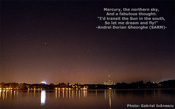
Mercury Transit 2006


Mercury Transit 2006, an effort from the Romanian Society for Meteors and Astronomy (SARM) with the support of Auckland StarDome Observatory, New Zealand, is a page of photographs about the 2006 transit of the Sun by the planet Mercury.

Andrei Dorian Gheorghe, one of those responsible for SARM's website, reminded me of our previous connection with New Zealand. He translated my poem Stargazing in New Zealand into Romanian as Privind La Stella. The poem stems from my visit to an observatory at Lake Tekapo.

Meanwhile, last week, Dave Whalley from the Outhouse Capital of Canada was also observing the transit.

A photograph by Dave Cortner was featured on Astronomy Picture of the Day